The coastal location of Owls Head Provincial Park makes it unsuitable for a golf course for many reasons, including:
- The need to protect the adjacent marine environment
- Nova Scotians’ limited public access to the coast (roughly 5% is publicly owned)
- Coastal erosion
- The storm surges that are intensified by global warming
- The incompatible climate of the site
Due to the weather along parts of the Eastern Shore, locals have been sceptical of the plan to establish golf courses at Owls Head Provincial Park.
“It is definitely colder and a lot foggier than in other places. Starts in April. When it is foggy, sometimes we can’t even see across the street to the neighours.”
Carol Ann MacPhee
“Many times we would leave Ship Harbour under sunny skies and then hit fog as we drove into Owls Head.”
Lynda McConnell
“I remember it as so hot in Musqoudoboit that we would head off to the beach and when we got there it was so cold with thick fog that we wished we had brought our winter coats. Now when we head in that direction on hot days we do put our winter coats in the trunk, just in case.”
Gloria Chaisson
The Data
The weather data confirms that it is cooler, windier, and foggier along the coast of the Eastern Shore.
“The islands and mainland shoreline of the Eastern Shore are directly exposed to the weather conditions coming in from the Scotian Shelf and Atlantic Ocean,” says the Eastern Shore Archipelago: Conservation and Scientific Assessment.
This Digital Wind Exposure Map for Nova Scotia has been made available through the Department of Lands and Forestry.
Figure 2 shows that Owls Head Provincial Park has a “very high” wind speed.
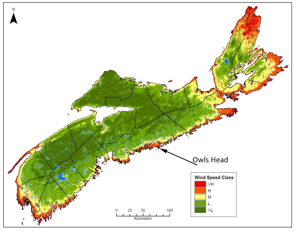
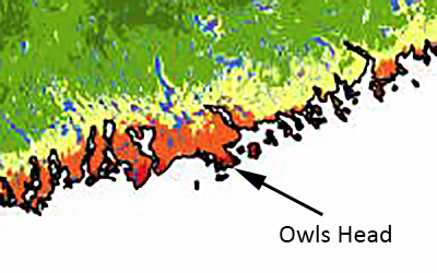
A topographical exposure (topex) map shows the overall wind exposure. Owls Head Provincial Park is classified as “exposed,” the highest exposure class based on average annual maximum wind speed and topex class.

Figure 4. Provincial wind exposure map and smaller section example based on combined average maximum wind speed data and topex class. (Click map to enlarge)
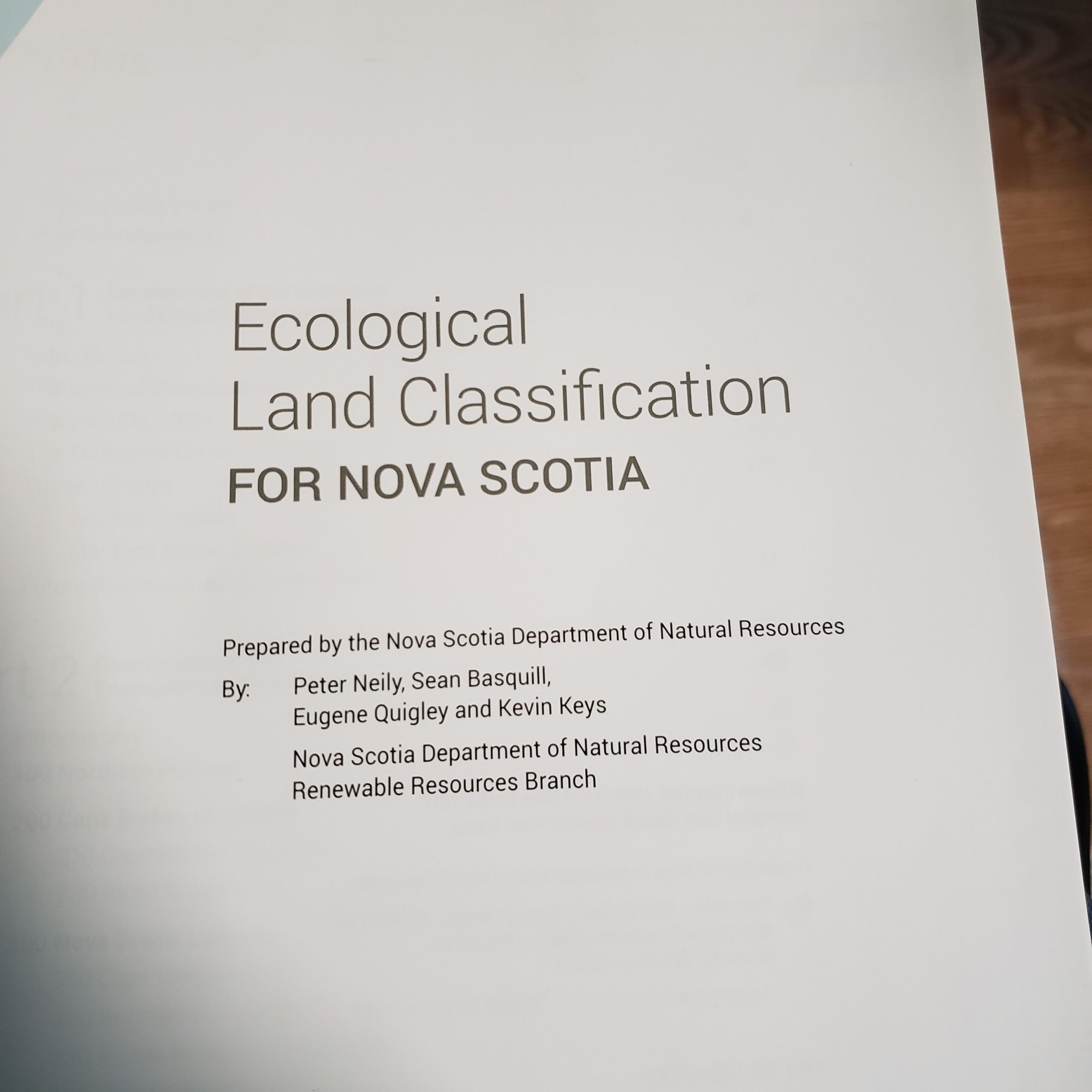
Published in 2017, “Ecological Land Classification for Nova Scotia” was prepared by Peter Neily, Sean Basquill, Eugene Quigley, and Kevin Keys, on behalf of the Nova Scotia Department of Natural Resources. Here is the climate summary of the Eastern Shore.
Ecological Land Classification for Nova Scotia
The Eastern Shore is a rugged and topographically complex ecodistrict extending from Chedabucto Bay (Guysborough County) to St. Margaret’s Bay (Halifax County). This long, narrow ecodistrict encompasses a wide range of landforms, geology, soils and ecosystem conditions. It is highly exposed, and prone to strong winds and extended periods of fog and cooler weather.
The Eastern Shore is the coldest coastline on the mainland. Across its more exposed headlands and summits, the landscape supports boreal and near boreal conditions. While shelter is provided behind the numerous islands scattered along the seaboard and deeper inlets, these sheltered bays still may be iced-in during the winter months. The climate is distinguished by high precipitation and low summer temperatures. Spring warm up is slow, but the frost free period is long.
In the west the ecodistrict is several kilometers narrower than in the east where coastal influences extended inward to encompass the entire Chedabucto peninsula with a moderating effect on the leeward side. For most of the ecodistrict the influence of the ocean extends inland until topography restricts further penetration (approximately the 60m contour). The effect of headlands, offshore islands, and coastal peninsulas (e.g., Liscomb Point), also influence the extension of coastal influence inland.Barrens underlain by granite correspond with vast expanses of exposed glacially scoured bedrock. Thin glacial tills create bookends at either end of the ecodistrict, while in between greywackes, quartzites, and slates comprise the bedrock geology. The Eastern Shore ecodistrict has a variety of coastal landforms including sandy beaches, sand dunes, offshore islands, and headlands.
In Summary:
- Highly exposed
- Prone to strong winds
- Extended periods of fog and cooler weather
- Coldest coastline on the mainland
- High precipitation
- Low summer temperatures
- Not suitable for golf courses
Sources:
Eastern Shore Archipelago: Conservation and Scientific Assessment
Digital Wind Exposure Map for Nova Scotia
Ecological Land Classification for Nova Scotia – click the photos to enlarge

All residents were quoted with their permission.

